Every photo, stamped with proof of where and when.
GPS Geo Tagging locks real GPS coordinates, date, time and a map straight onto your photos — so no one can question where your team actually was.


Free to start · No sign-up to try · Works fully offline
timestamp data
offline capture
stamped, saved photo
on captures
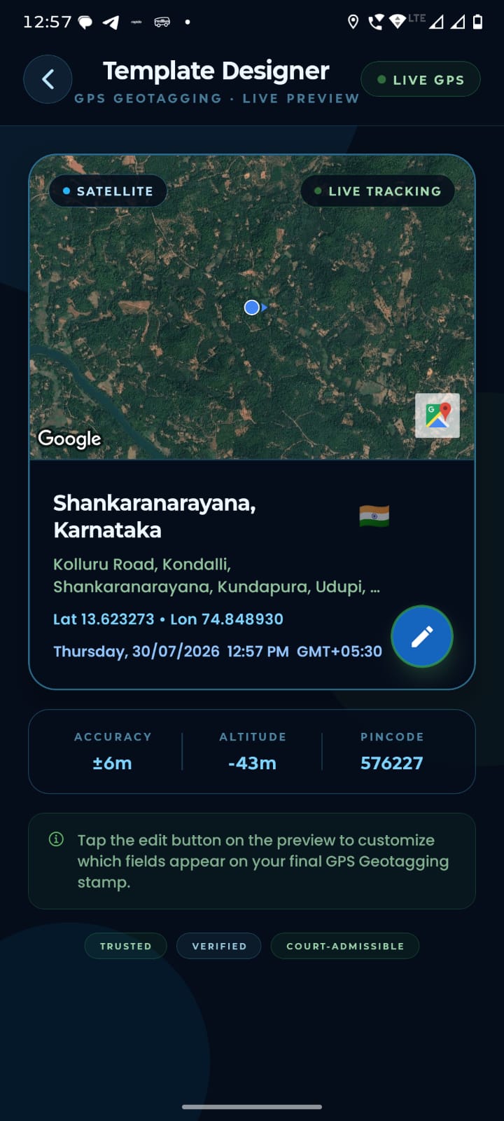
Real screens, straight from the field.
No invented mockups — this is exactly what opens, shoots and saves on a field worker's phone.
Launch & lock on
The app finds your live GPS position the moment it opens — no waiting around for a signal.
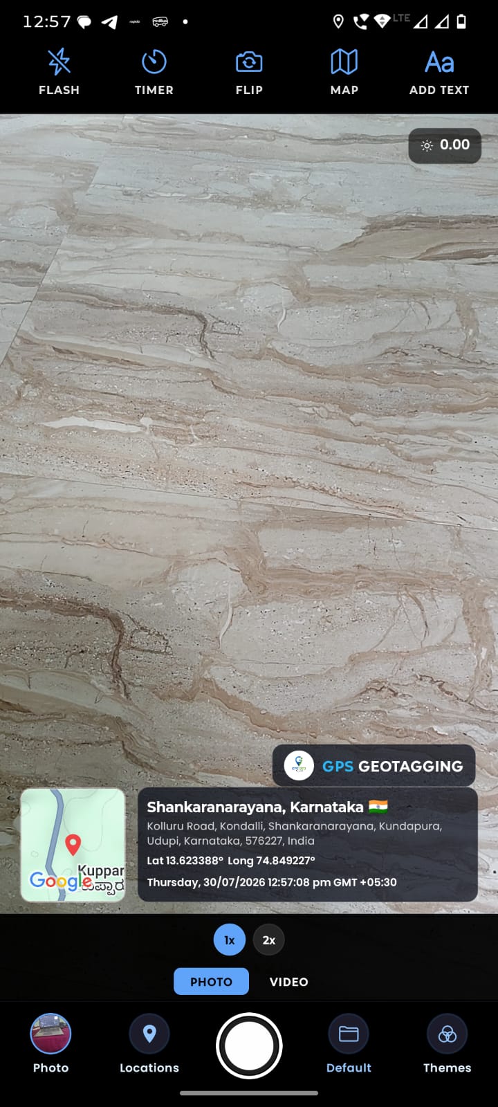
Stamp on capture
Coordinates, map, date and time are burned into the photo in the same second you take it.
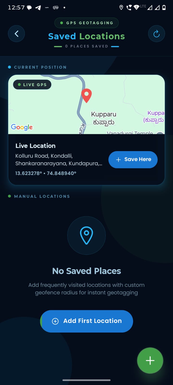
Manage your places
Save frequently visited sites with a custom radius for instant, one-tap geotagging next time.
Built so the proof can't be argued with.
Every stamp is pulled live from your device's GPS and clock — never typed in, never edited after the fact.
Live GPS coordinates
Latitude and longitude are read straight from the sensor and burned into the image the moment you shoot.
Tamper-proof timestamp
Date and time come from the device clock, not user input — there's no field to overwrite after capture.
Map thumbnail
A small live map is stamped alongside the coordinates, so location is visible at a glance, not just numbers.
Custom project tags
Add a project name, site note, or reference number to every photo before it's securely saved.
Works with no signal
Coordinates are captured from GPS directly, so stamping works even deep in the field with zero network.
Auto-organized files
Photos save themselves with location and time in the filename — nothing to rename before reports.
One camera, wherever proof of location matters.
Govt. & NGO staff
Hand in reports backed by photos no one can dispute the location or date of.
Site managers
Log progress photo-by-photo, each one tied to the exact spot and moment on site.
Real estate brokers
Show clients a verified location and date on every listing photo you send over.
Safety auditors
Build a trusted, time-ordered photo record of every required stop on your route.
From shot to stamped, in one tap.
Open the camera
Launch GPS Geo Tagging and point — it locks onto your live GPS position in the background.
Capture the shot
Take the photo like normal. Coordinates, date, time and map are stamped on instantly.
Save & share
The stamped photo is saved and named automatically, ready to send or attach to a report.
Get your data out,
exactly how you need it.
Taking the photo is only half the job. We make it incredibly easy to package your field data into professional formats for clients and managers.
PDF Reports
Generate multi-page PDF documents with photos and meta-data.
CSV & KML Export
Export all coordinates directly to Excel or Google Earth.
Cloud Sync
Auto-upload to Google Drive, Dropbox, or OneDrive folders.

Field teams rely on our stamps.
"We mandate this app for all 40 of our site inspectors. It eliminated disputes with contractors over when photos were actually taken."
"Works flawlessly off-grid. I survey remote conservation sites and the GPS lock is faster and more accurate than other tools I've tried."
"Clients love seeing the map and time right on the property updates. It adds a level of transparency that sets my agency apart."
Start stamping proof today.
Free to download. No account needed to take your first geo-tagged photo.
Questions, answered.
Coordinates are read directly from your device's GPS sensor at the moment of capture — the same signal your maps app uses — and stamped straight onto the image.
No. The stamp is burned into the photo when it's taken. There's no field in the app to type over it later, ensuring maximum trust for reports.
Yes. GPS positioning doesn't need mobile data or Wi-Fi, so you can stamp photos anywhere you have clear sky visibility for a satellite signal.
On our Free tier, there is no limit to how many photos you can capture and stamp. Pro users simply get advanced export and cloud features.